Daily Mail general war map of Europe
at National Library of Wales

The Royal Geographical Society (with the Institute of British Geographers), often shortened to RGS, is a learned society and professional body for geography based in the United Kingdom. Founded in 1830 for the advancement of geographical sciences, the society has 16,000 members, with its work reaching the public through publications, research groups and lectures.
Daily Mail general war map of Europe
at National Library of Wales

Daily Mail war map
at National Library of Wales

Daily Mail world map of war and commerce
at National Library of Wales

Large scale map of the Dardanelles
at National Library of Wales

Large scale war map showing scene of operations by the allied armies in Flanders
at National Library of Wales

Modern Palestine and Syria
at National Library of Wales

Philips' 2 miles to an inch strategical map of the British Front coloured to show height of land. All military aids and obstacles clearly indicated
at National Library of Wales

Philips' contoured map of the European battle fronts showing the new Europe
at National Library of Wales

Philips' large scale battle front map of Europe showing the allies' iron ring
at National Library of Wales

Philips' large scale contoured map of the Anglo-French front
at National Library of Wales
23 works
Daily Mail general war map of Europe
at National Library of Wales
Daily Mail war map
at National Library of Wales
Daily Mail world map of war and commerce
at National Library of Wales
Large scale map of the Dardanelles
at National Library of Wales
Large scale war map showing scene of operations by the allied armies in Flanders
at National Library of Wales
Modern Palestine and Syria
at National Library of Wales
Philips' 2 miles to an inch strategical map of the British Front coloured to show height of land. All military aids and obstacles clearly indicated
at National Library of Wales
Philips' contoured map of the European battle fronts showing the new Europe
at National Library of Wales
Philips' large scale battle front map of Europe showing the allies' iron ring
at National Library of Wales
Philips' large scale contoured map of the Anglo-French front
at National Library of Wales

National Library of Wales
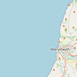
Ceredigion, United Kingdom